
As a motorcyclist, you come across GPX files everywhere: in WhatsApp groups with your riding buddies, on motorcycle travel forums and on websites full of beautiful routes. But let’s be honest: many riders load a GPX file into their navigation system without really knowing what is happening behind the scenes, or they have no idea what to do with it at all. And that is exactly where things often go wrong. You expect a perfect road full of hairpin bends, but your navigation sends you onto the motorway. Or you find a great route, but you are not sure how to get that GPX file onto your navigation device or into your app.
In this article, we explain step by step what a GPX file is, what the difference is between a route and a track, and how to import these files properly.
View all GPX downloadsWhat exactly is a GPX file?

GPX stands for GPS Exchange Format. It is essentially a universal text file, based on XML, that contains location data. Think of it as the global standard language for GPS devices.
A GPX file can contain three different types of data:
- Waypoints: Individual points on the map, such as a fuel station or that one perfect viewpoint.
- Routes: A series of points that your navigation system uses to calculate the roads between them.
- Tracks: A continuous series of thousands of coordinates, like a digital breadcrumb trail, forming an exact line on the map.
Important insight: a GPX file is not a ready-made, interactive set of navigation instructions. It is a file with raw data. The algorithm and settings of your specific navigation system ultimately determine how that data is displayed on your screen.
Why a GPX file is essential for your motorcycle adventure
Whether you are going out for an afternoon ride or planning a full motorcycle holiday, GPX files offer major advantages:
- Share the best roads: You can copy that one brilliant route from a fellow rider exactly.
- Plan at home, enjoy outside: You can create your route during the winter months on a large computer screen, so you can start riding as soon as the season begins.
- Relive great rides: Did you ride a fantastic mountain pass spontaneously? Save your ridden track as a GPX file and ride it again next year, or share it with other riders.
The crucial difference: route, track and waypoint

This is the absolute basic knowledge you need. Almost all navigation frustrations happen because riders do not fully understand the difference between a route and a track.
1. The route, calculated by your navigation system
A route consists of a start point, an end point and a handful of via points in between.
- How it works: Your device receives the instruction: “Take me from point A to B, via point C.” Your navigation system then calculates the roads between those points itself, based on the map, your settings, such as “avoid motorways” or “winding roads”, and the algorithm of that specific system.
- The advantage: You get clear turn-by-turn instructions, such as “turn right in 200 metres”.
- The disadvantage: If your navigation is set to “fastest route” and the person who created the route used “avoid motorways”, you may both end up riding a completely different road.
2. The track, fixed by the creator
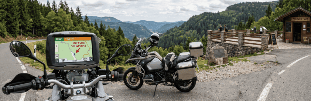
A track is a fixed line drawn over the roads on the map. It does not depend on the route settings of your navigation system.
- How it works: The system simply draws the line on the map. Many modern systems then turn that track into a temporary route that stays much closer to the original line.
- The advantage: A track stays much closer to the line that the creator rode or planned. You ride exactly the road the creator intended, whether you use a TomTom, Garmin or smartphone.
- The disadvantage: If a road is closed and you have to deviate, you need to look at the screen yourself to find your way back to that line.
3. Waypoints, POIs and points of interest
These are individual saved coordinates, such as a nice motorcycle café in the Eifel, a fuel station along the Autobahn or the top of a specific Alpine pass. You use them as useful reference points in your route.
The best tools to create and edit GPX routes
You no longer have to create routes on the tiny screen of your GPS device. There are excellent online platforms available. Good examples include the Dutch MyRoute-app and the German Kurviger, both of which make it easy to export GPX files. These are well-known route planning tools for motorcyclists, and they even allow you to choose specific algorithms for winding and hilly roads.
How do you import a GPX file?
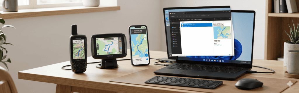
How you import files depends on the brand and device you use. Here are some common methods for different platforms.
Garmin, Zumo series
- Connect your Garmin to your computer with a USB cable.
- Open the storage of your Garmin and go to the
Garmin/GPXfolder. - Drag the downloaded GPX file directly into this folder.
- Disconnect the device and start it up. Go to the “Tracks” app or “Trip Planner” and import the file.
- Precise tip: always load the track and let your Garmin convert it into a route. Always turn “recalculation” OFF.
TomTom, Rider series
The easiest method is wireless via the cloud:
- Log in to TomTom MyDrive.
- Click “My Routes” on the left and choose “Import a GPX file”.
- As soon as your TomTom Rider is connected to Wi-Fi or your phone, the route automatically synchronises to your device under “My Routes”.
- Tip for TomTom: always choose to ride the route as a track for maximum accuracy.
Smartphone navigation apps, such as Calimoto, OsmAnd and Scenic
Navigation with a smartphone is extremely popular.
- Download the GPX file on your phone, for example from an email or website.
- Open the file. Your phone will often ask which app you want to open it with.
- Choose your favourite app, import the file and you can start riding. Make sure you have offline maps available for areas with poor reception.
Why does my GPX route sometimes differ?
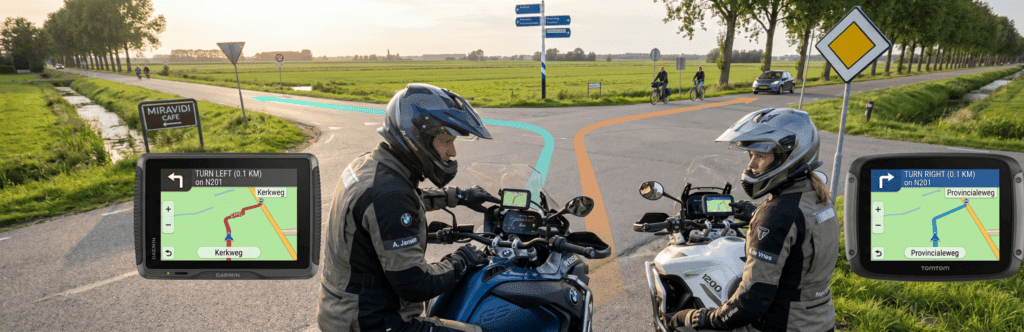
This is the number one frustration among motorcyclists. You are riding behind your buddy, both of you loaded the exact same GPX file, but your navigation says “turn left” and theirs says “turn right”. How is that possible?
- You loaded a route instead of a track: your device calculated a new road between the via points based on your settings.
- Different map data or map versions: if the route creator used a 2021 map and you are using a 2024 map, where a new roundabout has been added, the system can get confused while recalculating.
- Different routing profiles: one rider may have “avoid motorways” enabled, while the other has selected “maximum winding roads”.
Practical expert tips to prevent GPX problems

- Always use tracks: if the option is available, import the track and let your navigation turn it into a route without allowing it to adjust the surrounding roads.
- Turn automatic recalculation OFF: if you take a wrong turn or encounter a diversion, your navigation may immediately search for a new, often faster and more boring, road to your destination. Turn recalculation off and simply zoom out slightly on the map to ride back to the planned line yourself.
- Check for strange loops: review the route at home on your navigation screen or computer. Sometimes a via point is placed just on an exit ramp or in a side street, forcing your navigation to create a strange loop.
- Keep the bigger picture: never rely blindly on the screen. Before you leave, roughly study which villages, towns or rivers you will pass.
- Offline maps: especially when using apps on your phone, make sure the maps are downloaded. In mountains or forests, mobile reception can disappear, and a GPX file without a background map is not very useful.
Conclusion
A GPX file is a fantastic tool for every motorcyclist, as long as you understand exactly what kind of data you are giving to your navigation system. But a GPX file is only data; your device makes the final decisions. By consistently using tracks and switching off automatic recalculation, you ride with less frustration and can fully focus on what really matters: the corners, the scenery and the freedom of riding.
FAQ – Frequently asked questions about GPX files
A GPX file, or GPS Exchange Format, is a universal digital text file containing GPS data, such as coordinates for routes, tracks and waypoints.
For most motorcyclists, a track is best. Because a track is a continuous line made up of thousands of coordinates, your navigation stays much closer to the road intended by the creator.
This usually happens when both of you load the file as a route. Your devices may have different settings, such as shortest route versus fastest route, or different map versions, causing both systems to calculate a different road between the via points.
Yes. Use online platforms such as MyRoute-app or Kurviger. You can place your own waypoints, let the algorithm search for the best roads and then export everything as a .gpx file to your computer or phone.
Yes, the GPX file itself contains the route data and does not need internet. However, you do need to make sure the actual road maps are downloaded and available offline on your navigation device or smartphone app. This depends on the app or system you use.